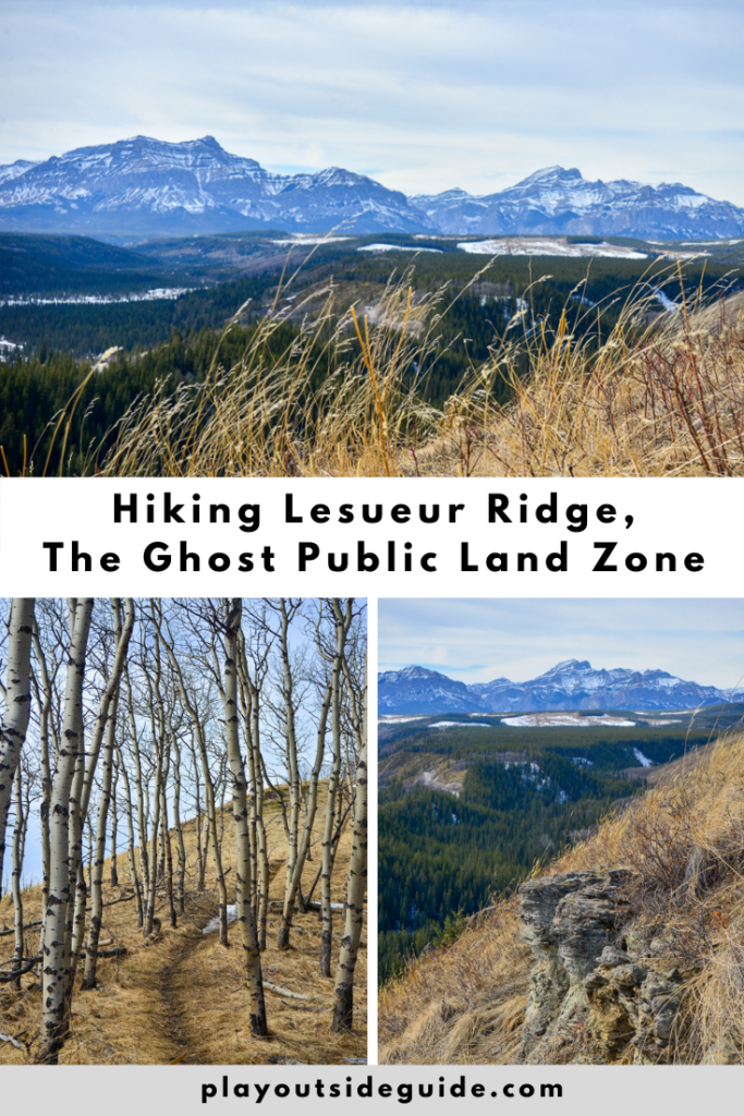
If you’re looking for an early season hike without crowds or (much) snow, Lesueur Ridge, north of Cochrane, is a great option.
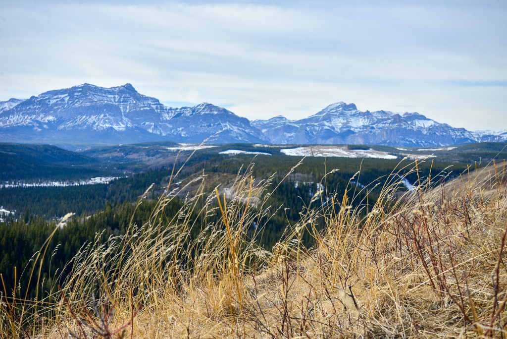
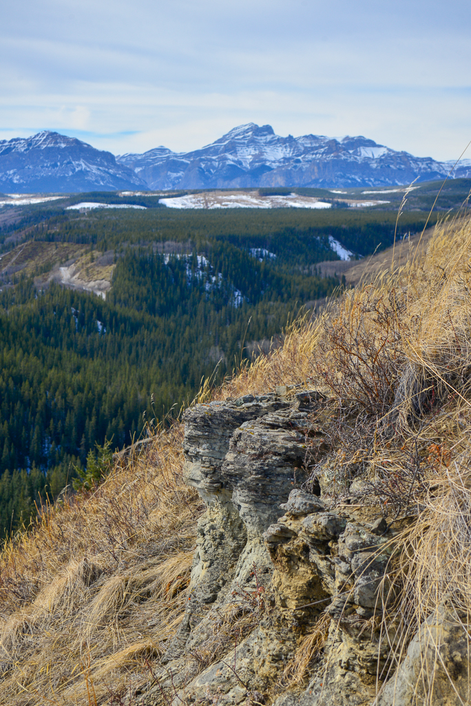
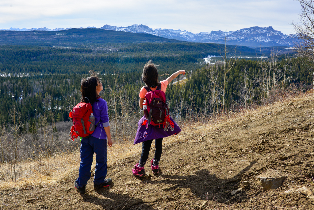
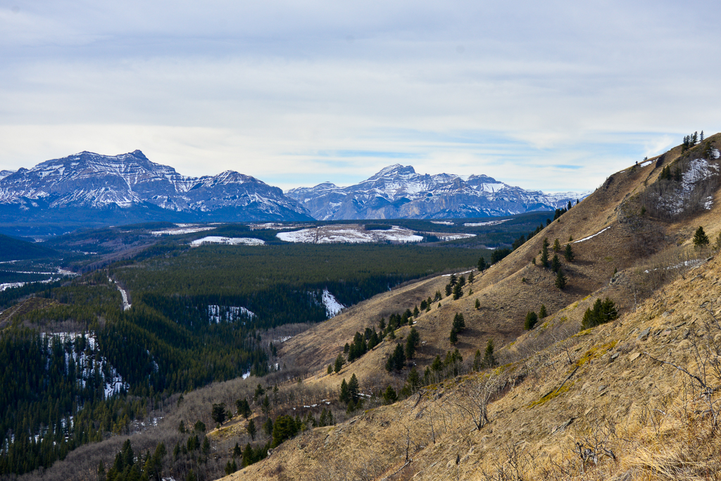
Lesueur Ridge is a long sandstone ridge overlooking the Ghost River Valley. Hike this trail early in the season, before the leaves come out, for mountain views; in April/May to see wildflowers; or autumn when the aspen leaves turn golden. You don’t even need to do the whole ridge to get good views! We heard the top of the ridge was snowy and that the lower trail was quite muddy, so we hiked to the grassy promontory and back for a 5.5 km round trip hike (versus 8 km for the complete loop).
We hiked Lesueur Ridge on March 13, 2021. While the first 500 metres were a mix of packed snow and mud, after that, the trail was mostly dry! It was also very quiet – save for gunshots and ATVs in the distance. Although the parking area was pretty full, we only saw one family and one couple on the trail. It looks like most people leave their vehicles here and ride ATVs.
All in all, we enjoyed this trail a lot more than we thought we would. The aspen forest is beautiful and the mountain views are lovely. Bonus that it’s only one hour from NW Calgary.

Table of Contents
Lesueur Ridge Trail Description
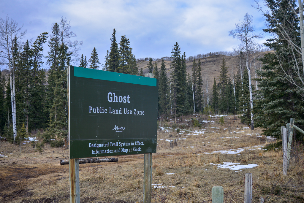
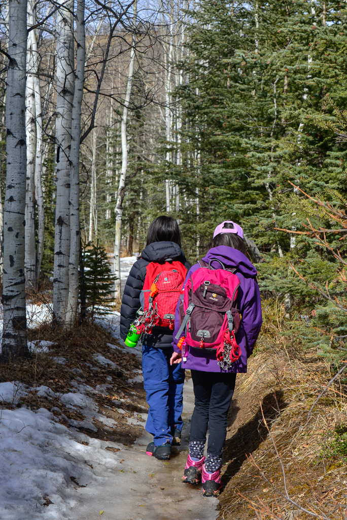

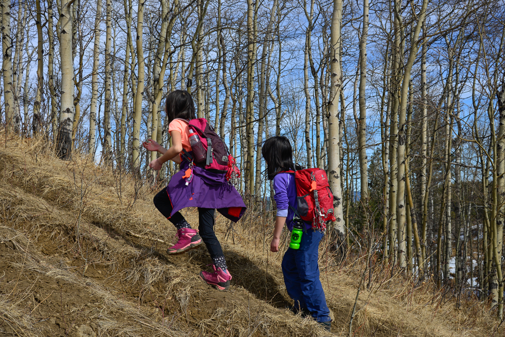
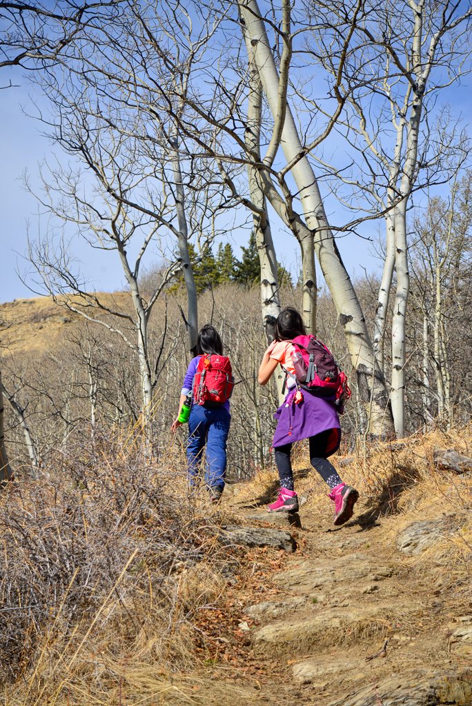
Start out on the narrow, but well defined trail just west of The Ghost Public Land Use sign. After 700 metres, you’ll come to a junction. Stay right to do the loop counterclockwise for the best views. From here, the trail climbs through mixed forest (aspens and spruce trees) to gain the ridge. Just when you think you’re at the top, there will be another bump, and then another, but the climb is short, so it isn’t too grueling. Looking west, the prominent peaks are Devil’s Head and Black Rock Mountain.
About 2 kilometres from the start, a spur trail heads off to a grassy promontory at left. This is a good break spot which offers nice mountain views (sadly, the ridge summit is at the edge of a clearcut and isn’t that picturesque) and is the perfect destination if your kids aren’t keen on doing the whole 8 km loop. The spur trail is often overgrown and is traveled by lots of deer, so do a thorough tick check after walking through the long grass.
Return to the main trail to reach the summit. At the high point and northern end of the loop (3 km from the start), take the cutline left/downhill. After a kilometre, make another left onto a road. In 500 metres, take the single track trail along Lesueur Creek. The trail will soon open up taking you along grassy slopes above the creek. This section is a good place to see wildflowers in late April and May!
Around 7.3 km, you will reach the first junction; turn right to go back to the car.
For more information, see Gillean Daffern’s Kananaskis Country Trail Guide, Volume 3.

Lesueur Ridge at a Glance
- Distance: 8 km loop (or 5.5 km round trip to grassy promontory and back)
- Elevation Gain: 350 metres (208 metres to grassy promontory)
- Stroller friendly? No
Directions to Lesueur Ridge
- Directions: Click here for Google Maps directions or see map below. Your turnoff from Highway 40 is immediately after Richards Road on your left (easy to miss – looks like a driveway). Continue on the gravel road for 2.8 km and park on the right just past The Ghost Public Land Use sign.
- Parking: Park between the cattle guard and small bridge over Lesueur Creek. There is small, unpaved parking area on the side of the road.
- Trailhead: Unmarked, just west of The Ghost Public Land Use sign.
Know Before You Go
This trail is in the public land use zone, off the beaten track, so there are no amenities and the trail is not marked. There is no cell phone service at the trailhead (but service at the top of the ridge), so leave a trip plan with someone at home with instructions on what to do if you’re not back by the given time.
The township road can be REALLY bad after the bridge (vehicles were getting stuck in the mud!), so park on the east side of it.
What to Bring
Disclosure: This section includes affiliate links through which I may earn a small commission at no extra cost to you. Thank you for supporting our small family business!
Good hiking boots, a down hoody/fleece, toque, gloves, and windproof/waterproof shell are recommended year round.
For winter conditions, we recommend traction devices such as Kahtoola Microspikes (Available from Amazon and MEC), or Hillsound Trail Crampons (Available at Amazon and Sport Chek) and trekking poles with snow baskets. Wear base layers, insulated winter boots, a down jacket and windproof/waterproof shell (or insulated ski jacket/parka), gloves or mittens, and a toque. See our fall/winter hiking gear guide for product recommendations.
You should also carry The Ten Essentials including: water, extra food, extra clothes, a headlamp, a GPS / satellite communicator / compass, and map of the area, sunscreen (this one is safe for babies), bug spray (this deet-free one contains 20% icaridin and will repel ticks), and bear spray. Carry bear spray in a Frontiersman Bear Spray Holster or Scat Belt.
More Ridge Walks
- Vent’s Ridge (White Buddha), Elbow Valley
- Powderface Ridge, Elbow Valley
- Centennial Ridge, Kananaskis Valley
- King Creek Ridge, Peter Lougheed Provincial Park
- Pocaterra Ridge, Peter Lougheed Provincial Park
- Parker Ridge, Banff National Park
1 comment
[…] Lesueur Ridge‘s south exposure means it dries out quicker than other trails in Kananaskis. Enjoy lovely mountain views as you head west (do the trail counterclockwise), wildflowers in spring, and blazing aspens in autumn. […]
Comments are closed.