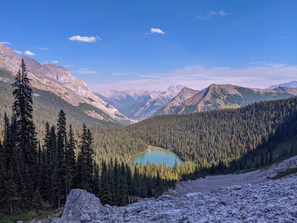
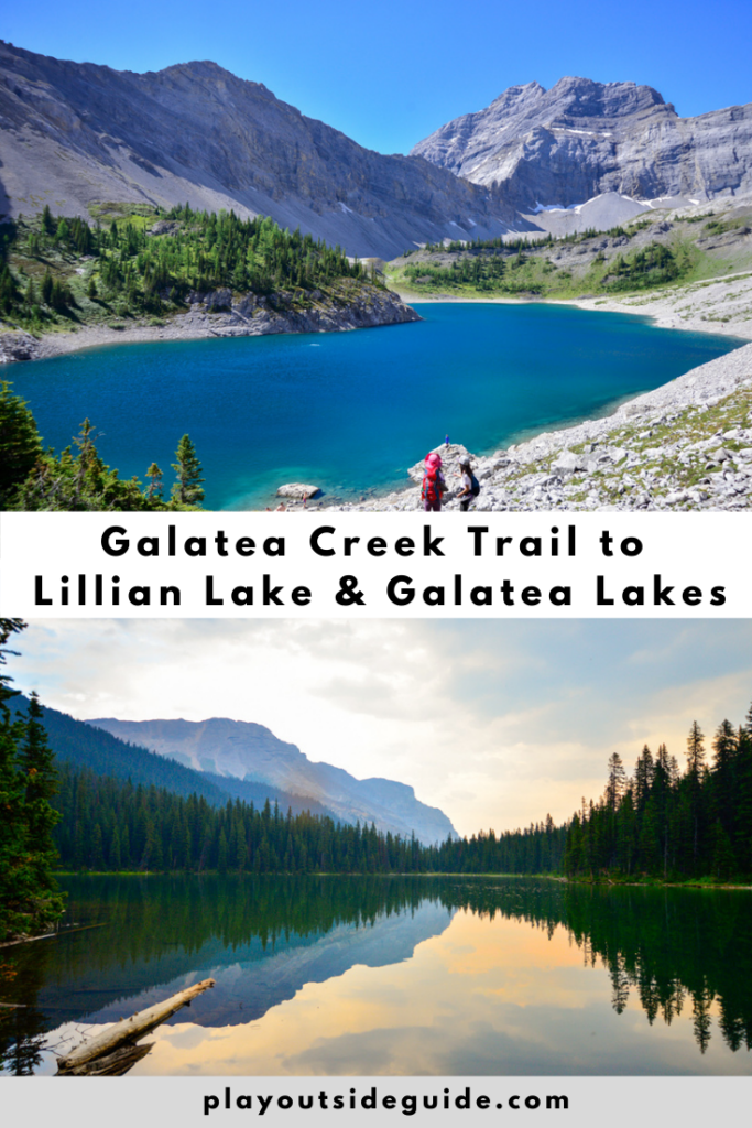
Galatea Creek Trail takes you past waterfalls and over 11 bridges to Lillian Lake Backcountry Campground. From there, you can hike to Lower and Upper Galatea Lakes, two sparkling alpine lakes.
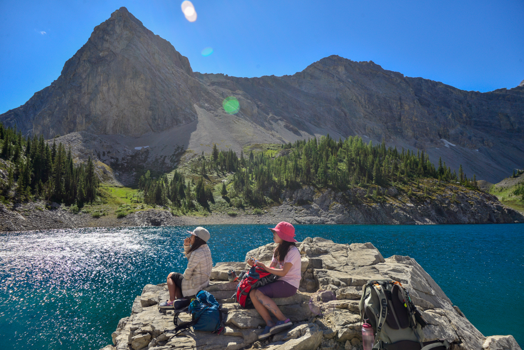
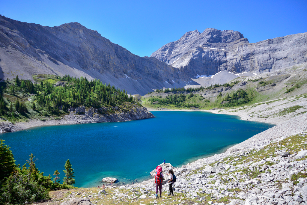
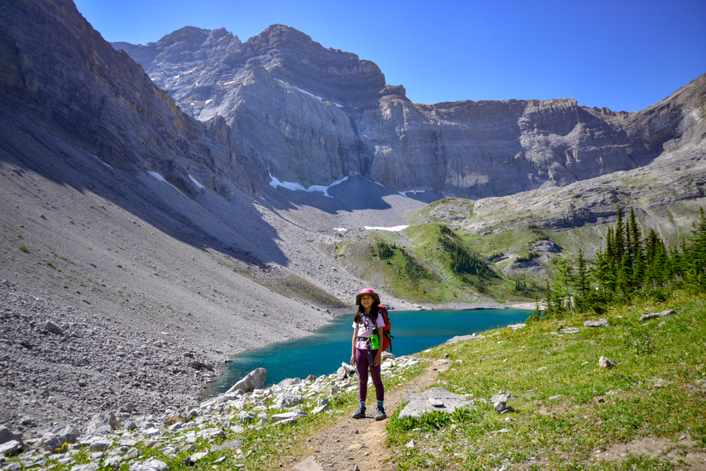
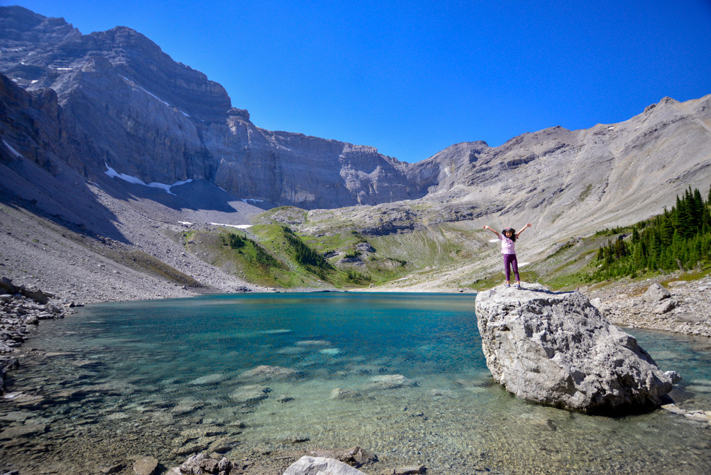
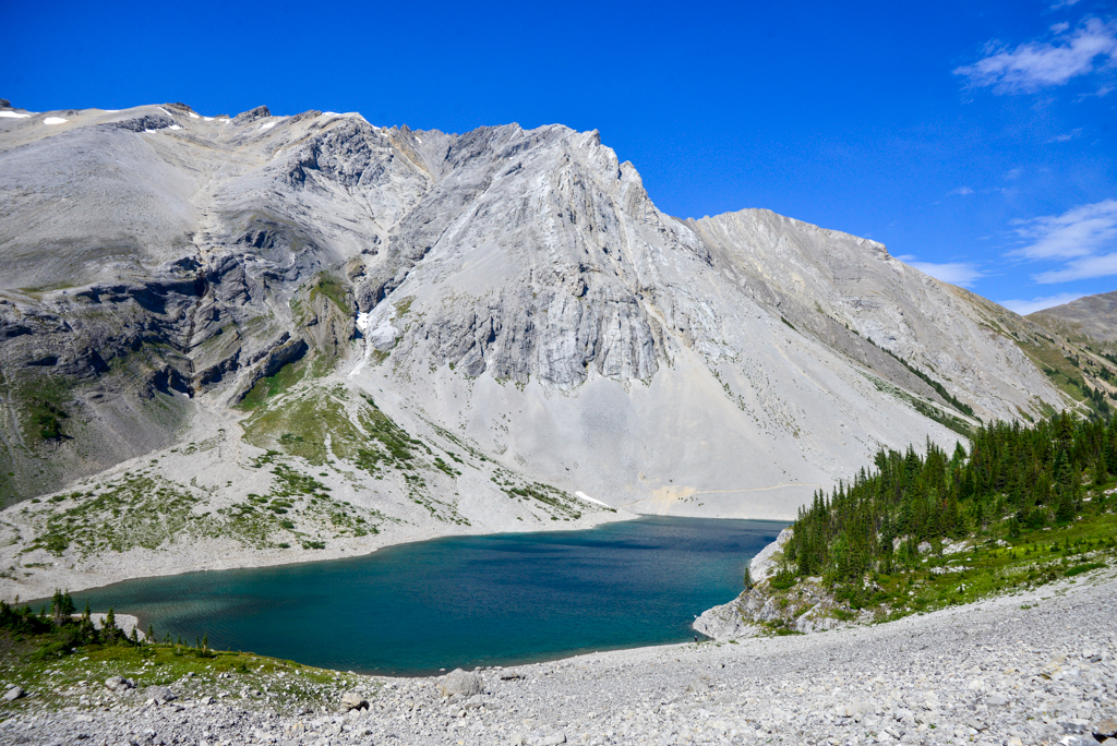
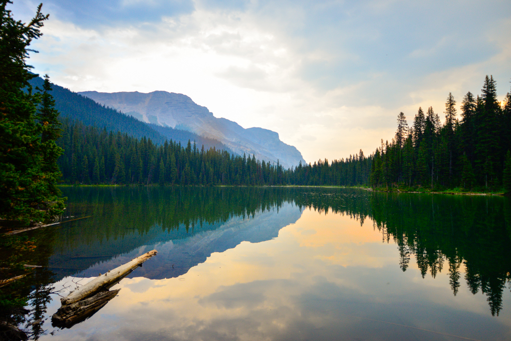
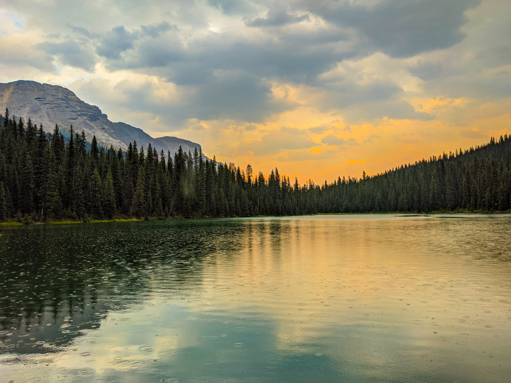
With bridges, waterfalls, a backcountry campground, and three lakes, it’s easy to see why Galatea Creek is such a popular trail. While Lillian Lake makes a nice picnic or camping spot, it’s well worth it to hike 1.3 km further to Lower Galatea Lake. Set in a cirque, the dazzling turquoise lake has crystal clear (and cold!) water. Continuing west will take you to Upper Galatea Lake, a smaller lake the same stunning shade of blue.
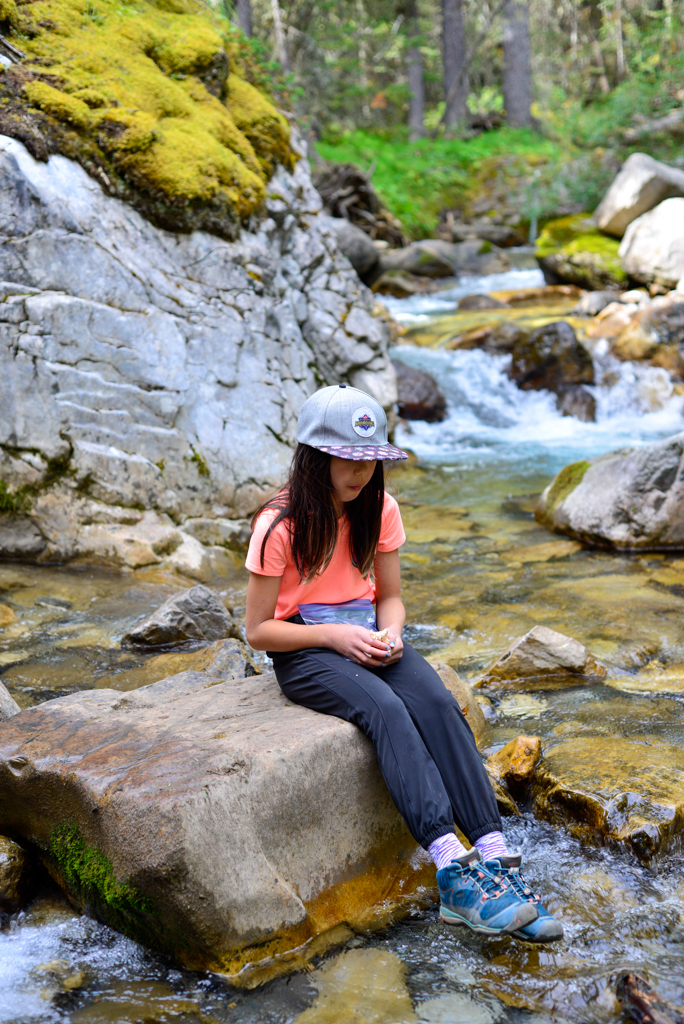
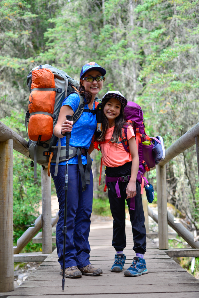
The kids and I stayed at Lillian Lake Backcountry Campground so we could day hike to Galatea Lakes the next day, but if you get an early start, you could hike to to all three lakes in one day.
Table of Contents
Galatea Creek to Lillian Lake: 6.3 km, 475 m elevation gain
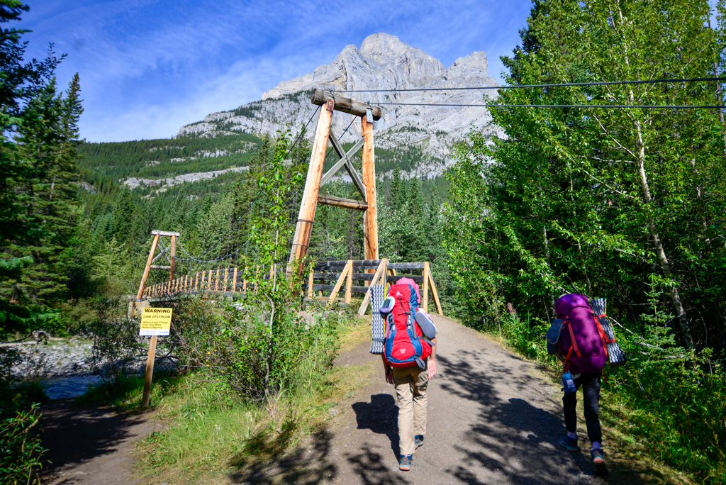
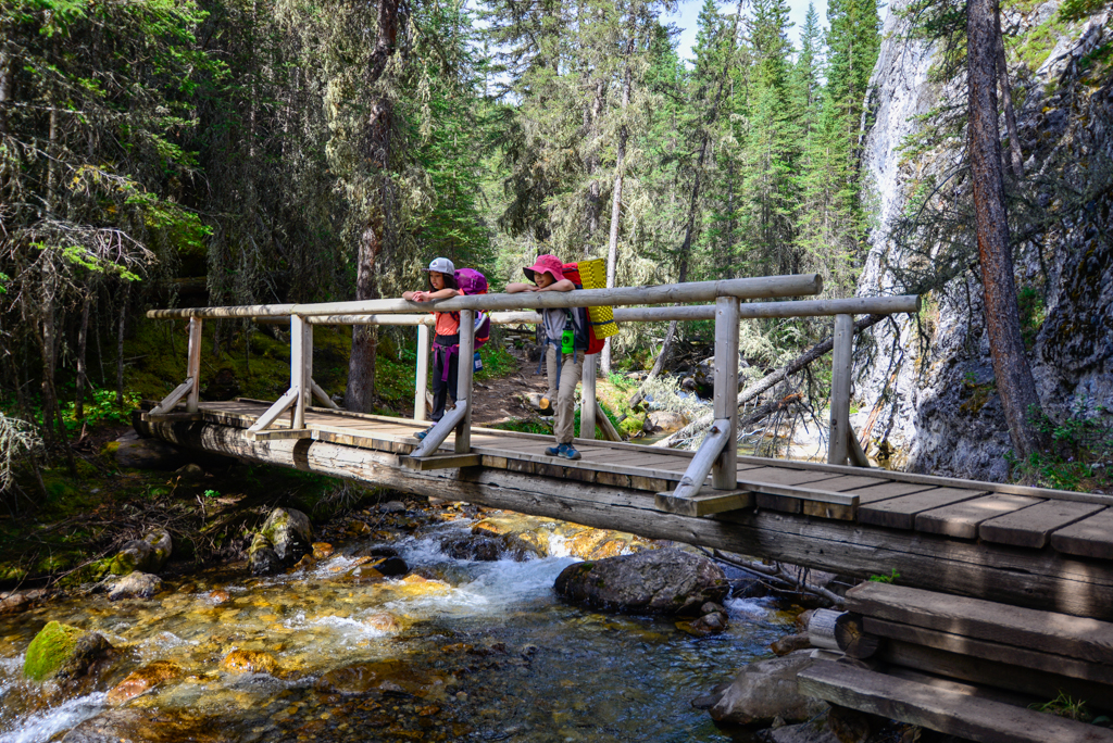
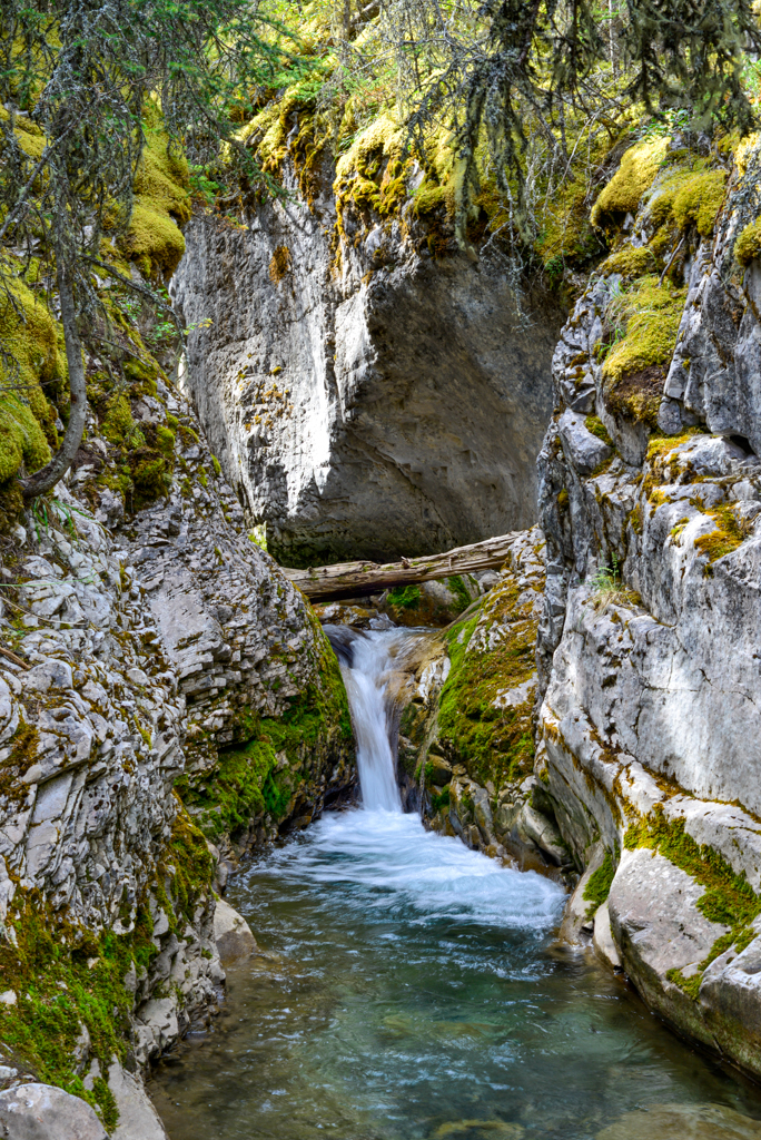
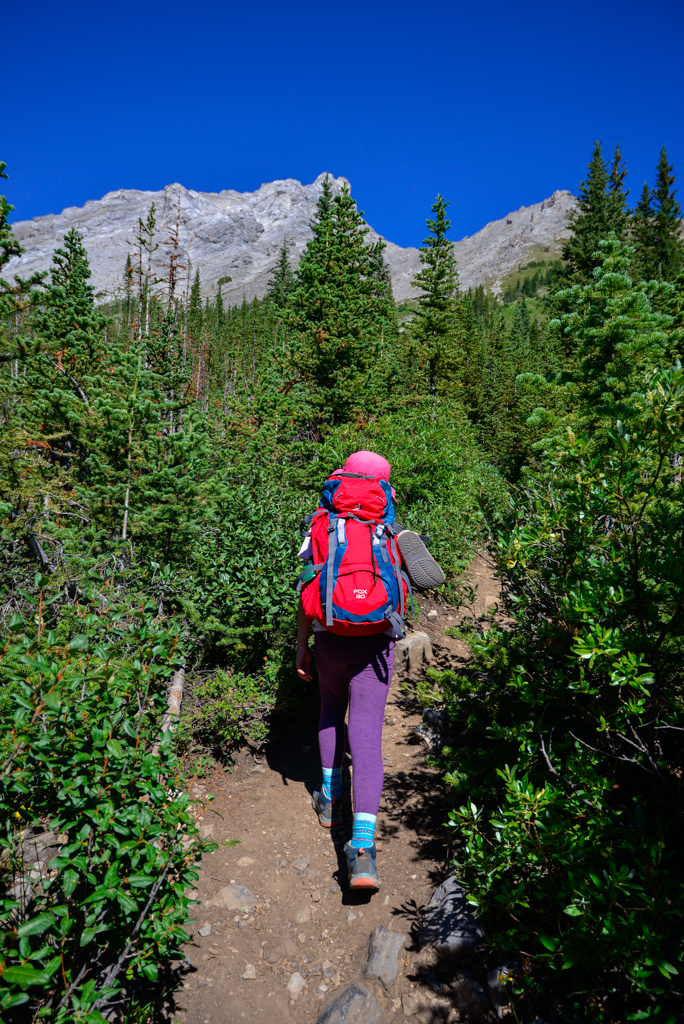
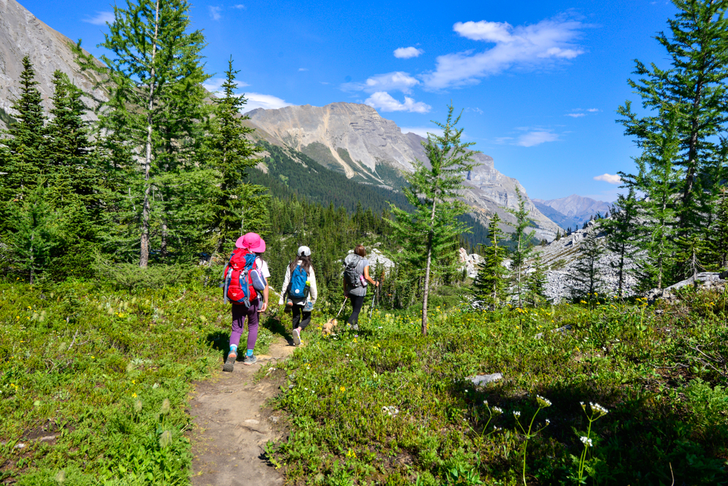
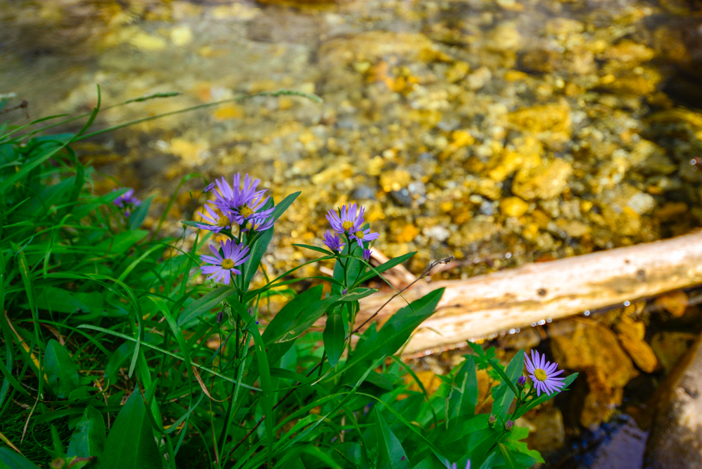
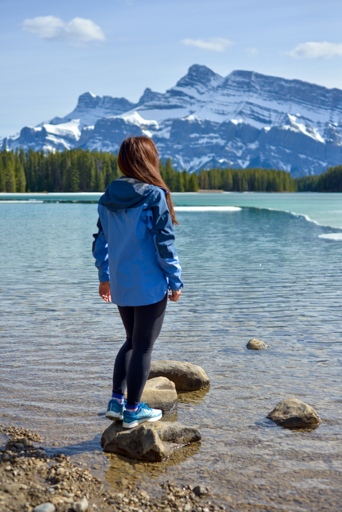
From the Galatea Creek parking lot, go down the hill to the suspension bridge over the Kananaskis River. At the first junction, go left to head west on Galatea Creek Trail (turning right/north will take you to Kananaskis Village). Mountain views are limited as you hike through the forest, criss-crossing the creek, but lots of little waterfalls and wildflowers offer a change of scenery. Remember to make noise OFTEN so you don’t surprise a bear, especially around the creek. Your voice needs to be louder than the water.

Since it’s all uphill to Lillian Lake, expect this well-marked trail to take 1.5-3 hours (the latter if you’re backpacking with kids). Once you reach the lake, relax at a lovely lakeside bench, or set up camp if you have a backcountry permit.
Lillian Lake to Lower and Upper Galatea Lakes: 2.6 km, 190 m elevation gain
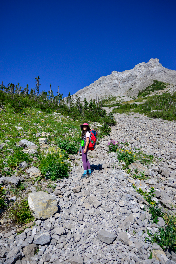
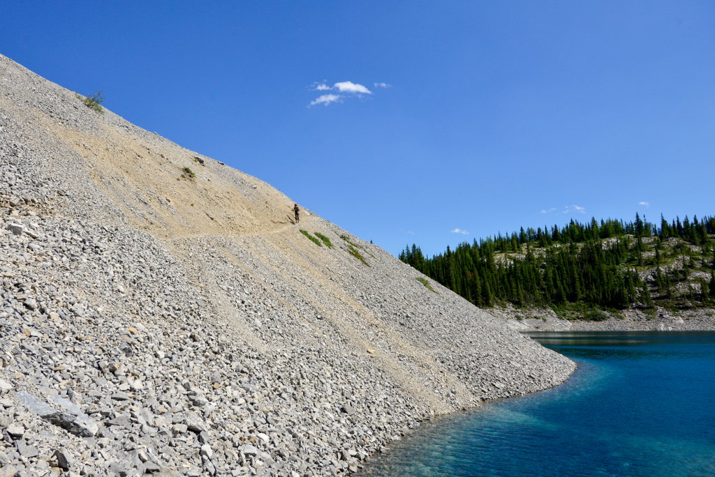
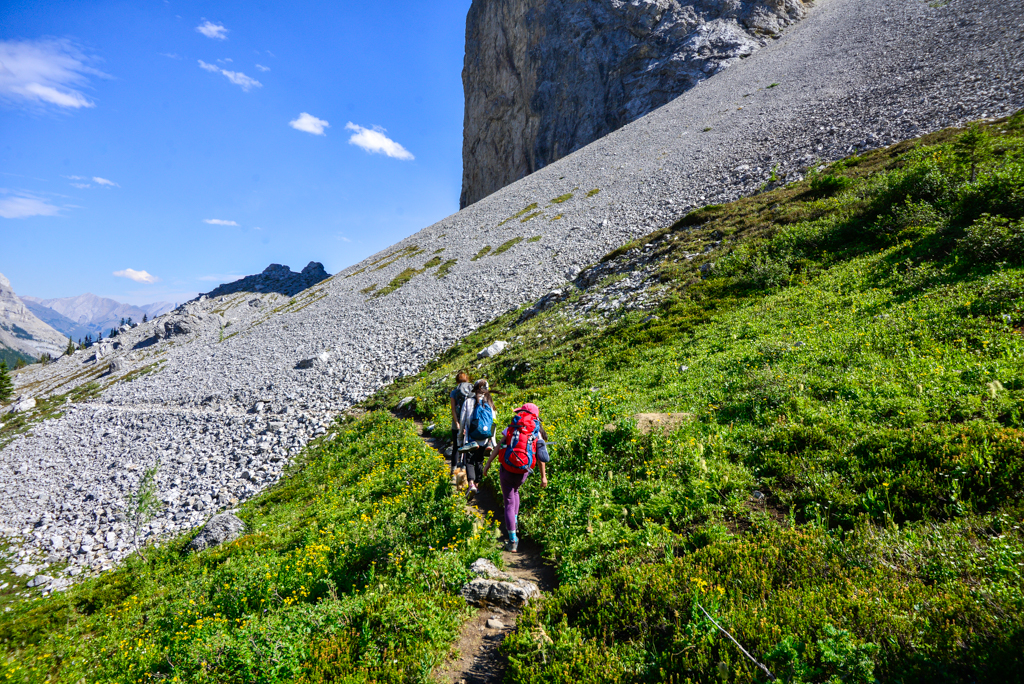
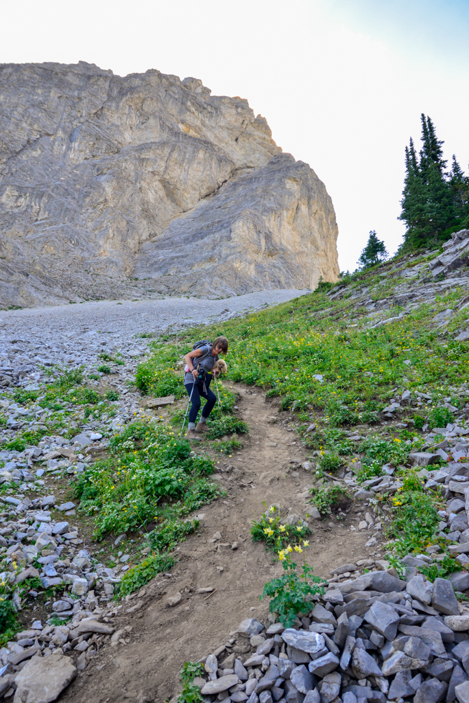
Follow the signs to the campground, then look for the washroom sign on your right. As you head towards the outhouse, you’ll see a sign for Galatea Lakes and Guinn’s Pass. Continue west and uphill until you reach the junction for Galatea Lakes; then turn left. It’s steep almost right away; you will gain close to 200 metres of elevation in about a kilometre!
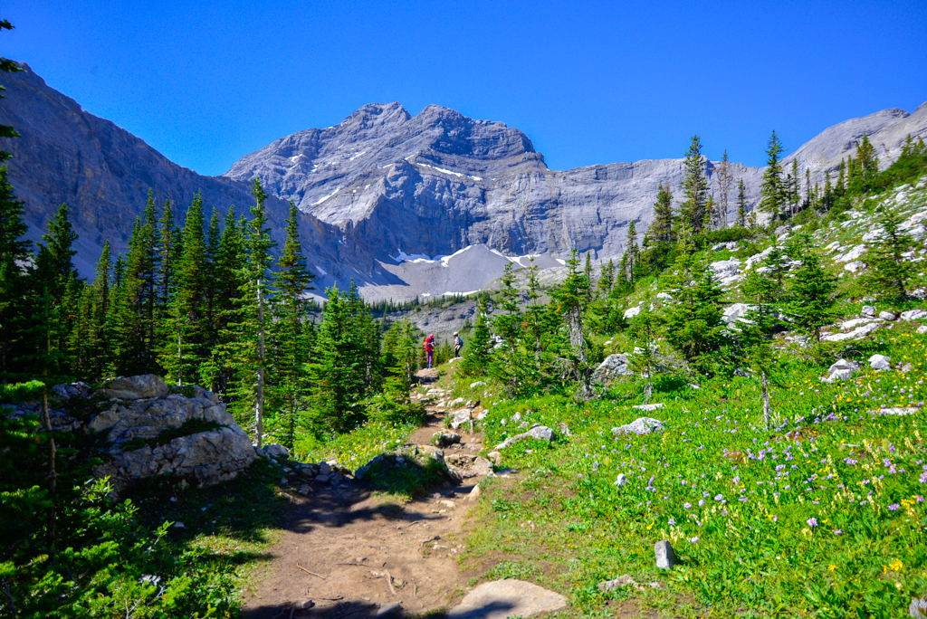
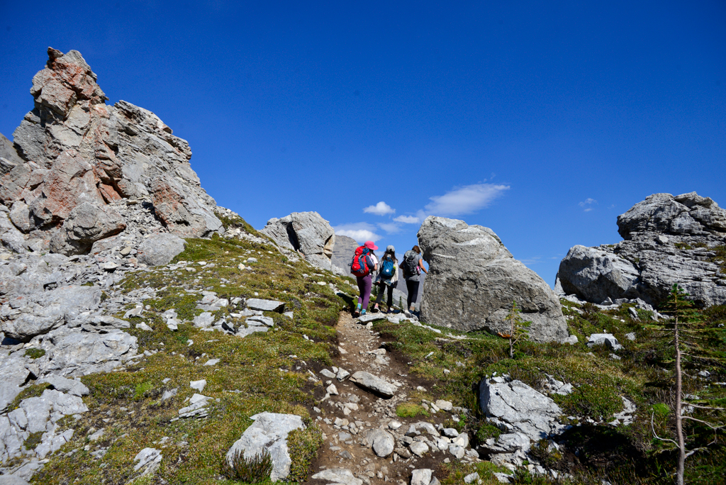
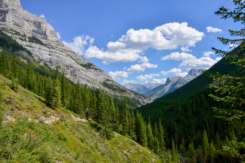
As soon as you get out of the trees, the views improve with every step. Watch your step on the scree though! Continuing westward, the trail descends to the right-hand shore of beautiful Lower Galatea Lake. There are a few large rocks along the sparkling turquoise waters that make great picnic or fishing spots. If you’re lucky, you’ll spot pikas or weasels while you take in the gorgeous view.
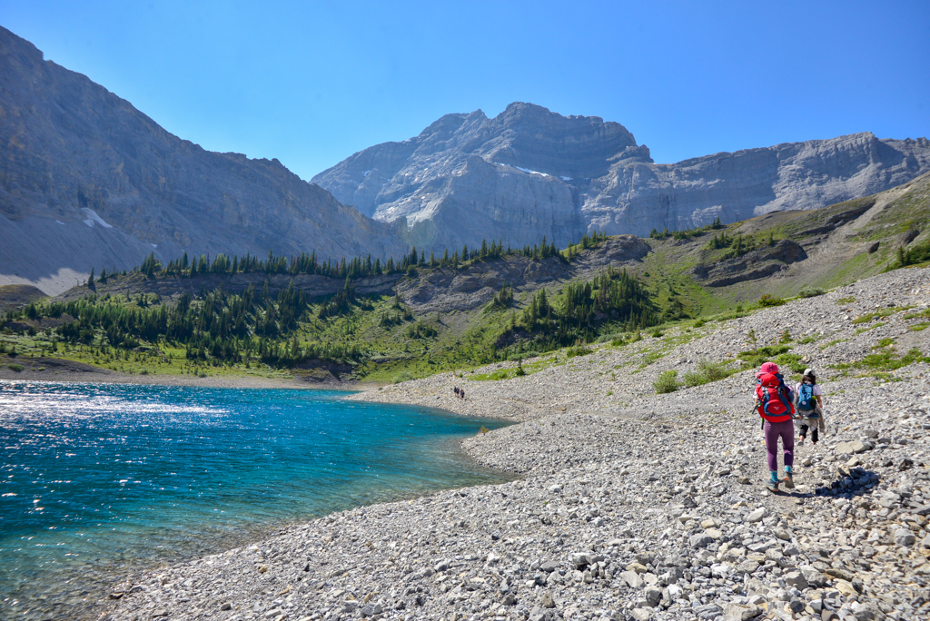
To reach Upper Galatea Lake, follow the trail around the west side of Lower Galatea Lake and head left /south. Although it’s only a little farther (1.3 km), not many people visit the second lake. When we visited in late August (midweek), we were the only people there! It was a nice treat after seeing about a hundred hikers on the way in to camp.
The easiest way back is to return the way you came, but we made a loop to keep things interesting. If doing the loop, be advised that this section is NOT marked. There is a thin, defined trail with lots of loose rock and a crazy steep descent to the campground, so attempt at your own risk!

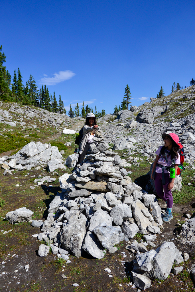
- To do the loop, head east, away from Upper Galatea Lake, then traverse the scree slope south of Lower Galatea Lake. Pass through a meadow of wildflowers and another scree slope, making your way towards a large cairn. From here, go straight to reach the campground (we tried going left at the the cairn to go around the lake but turned back because we didn’t want to bushwhack). You can see Lillian Lake straight ahead of you until you head back into the trees, so it’s easy to stay on track. The trail takes you right to the campground. From there; head left to get on Galatea Creek trail, then turn right to return the way you came.
We lucked out with warm weather, so we could laze at Galatea Lakes for hours, but it tends to be windy and chilly up there, so bring an extra layer!
Camping at Lillian Lake Backcountry Campground
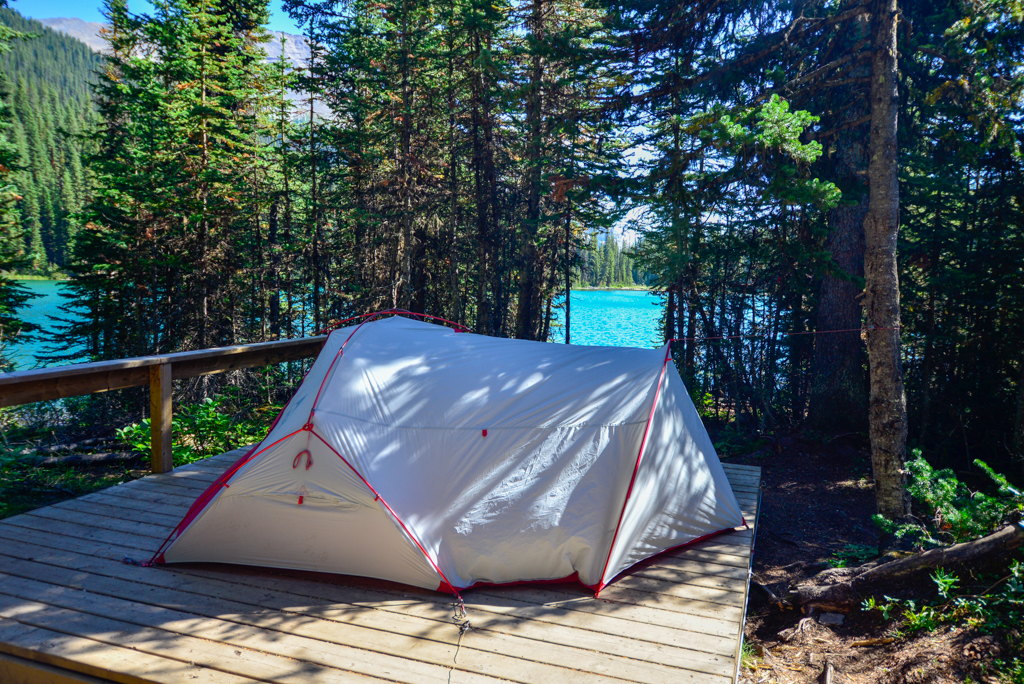
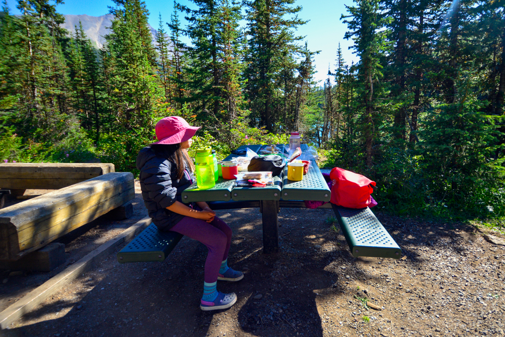
Lillian Lake Backcountry Campground has 17 campsites near the lake. Nine sites have raised tent platforms, and many have lake views! Campground amenities include bear lockers, communal cooking/dining area, outhouses, and communal fire pit (Confirm if firewood is available. As of July 2024, it looks like firewood is provided, but it wasn’t when we were there). We loved our private, spacious site which was a short walk from the water and cooking area.
A backcountry permit is required to camp at Lillian Lake Backcountry Campground. Book early as this popular campground fills up fast.
Galatea Creek Trail at a Glance
Distances are one way. If you hike to all three lakes, it is about 17.8 km round trip with 665 metres elevation gain.
- Galatea Creek parking lot to Lillian Lake Backcountry Campground: 6.3 km, 475 metres elevation gain
- Lillian Lake to Lower Galatea Lake: 1.3 km, 190 metres elevation gain
- Lower Galatea Lake to Upper Galatea Lake: 1.3 km, minimal elevation change
- Stroller friendly? No
- Washrooms: Pit toilets at trailhead and Lillian Lake
- Difficulty: Moderate to Lillian Lake, strenuous to Galatea Lakes (however, if backpacking, this route is quite strenuous. If it’s your first time backcountry camping with kids, I’d recommend trying Elbow Lake or The Point first.)
- Time: Allow 6-7 hours for adults.
Going further: You can hike to Guinn’s Pass, Ribbon Lake & Ribbon Creek, and South Buller Pass from Lillian Lake. See the Canmore & Kananaskis Village Map (Amazon Affiliate link) for details.
When to Go
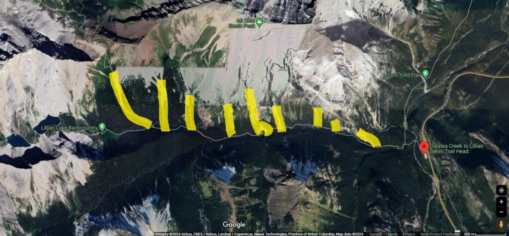
Image credit: Google Maps. Avalanche paths marked by Karen Ung.
- There is an ANNUAL TRAIL CLOSURE from May 1 – late June to allow the trail to dry out. For more information, please visit: https://www.albertaparks.ca/parks/kananaskis/kananaskis-country/advisories-public-safety/annual-trail-closures/
- Significant avalanche danger exists. The best time to do this trail is mid July to early October (conditions permitting – check the trail report before you go!).
Know Before You Go
- A Kananaskis Conservation Pass is required to park in Kananaskis and a Backcountry Permit is required to camp at Lillian Lake Backcountry Campground.
- Be louder than the creek to make your presence known. A surprised bear is a dangerous bear. To learn more ways to stay safe in bear country, see our story: Bear Safety Tips for Hikers and Backpackers.
- Since the trail is in the shade and near water, it tends to be muddy. Waterproof hiking boots are recommended.
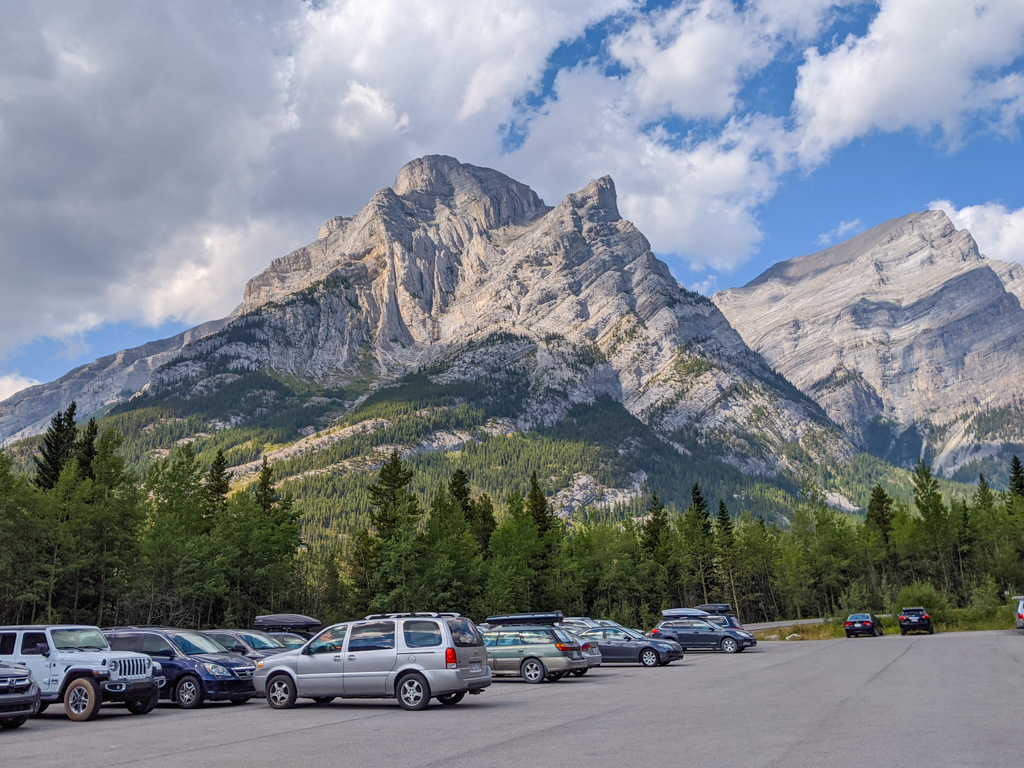
- This is an extremely popular trail, so you should arrive early to get parking. Outhouses are often lined up, so we usually stop at Barrier Lake Visitor Centre on our way to the trailhead. Bring toilet paper and hand sanitizer with you AND PACK OUT ALL TRASH (toilet paper, diapers, feminine hygiene products, apple cores, etc.).
- Dogs must be kept on a leash at all times in provincial parks.
What to Bring
Disclosure: This section includes affiliate links through which I earn a commission on qualifying purchases at no extra cost to you.
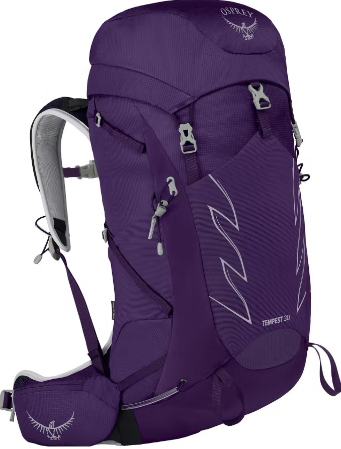
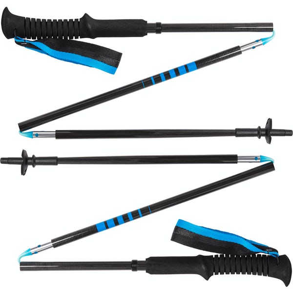
Waterproof mid-height hiking boots, a down hoody or fleece, toque, gloves, and windproof/waterproof shell are recommended year round. Trekking poles are useful for long hikes, steep descents, or when you’re carrying a fully-loaded backpack (or are babywearing). You should also carry The Ten Essentials including: water, extra food, extra clothes, a first aid kit, headlamp, GPS / compass / Garmin inReach Mini 2 satellite communicator* and map of the area, mineral sunscreen, bug spray (this DEET-free insect repellent contains 20% icaridin and will repel ticks), and bear spray. Carry bear spray in a Bear Spray Holster or Scat Griz Bear Spray Running Belt.
*A Garmin inReach Mini 2 satellite communicator is highly recommended for contacting Search & Rescue and emergency contacts in the event of an emergency, or communicating with friends and family when you are out of cell phone range. You can send text messages and your GPS coordinates via satellite, but a monthly service plan is required.
Getting Here
Galatea Creek Trailhead is located on Highway 40 South, 10 kilometres south of the Kananaskis Village turnoff. Click here for Google Maps directions.
Related Posts
