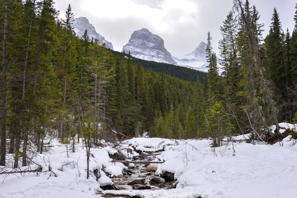
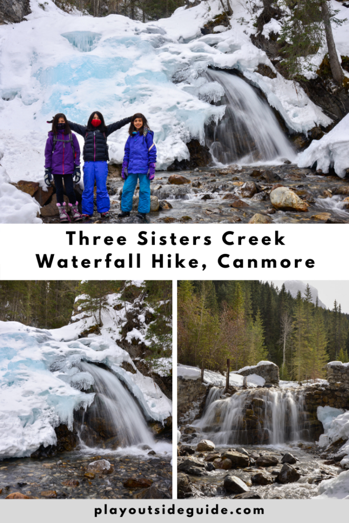
For a lovely, short hike in Canmore, follow Three Sisters Creek to two waterfalls. On a clear day, you can see the peaks the creek is named for from the bridge!
When you’re feeling kind of lazy, but want mountains and waterfalls without crowds, try Three Sisters Creek! We were pleasantly surprised by how pretty this little hike was, and we enjoyed a picnic at the picnic table near the creek. The only thing missing was extra socks (one kid fell in the water as she was messing around).
Table of Contents
Three Sisters Creek Route Description
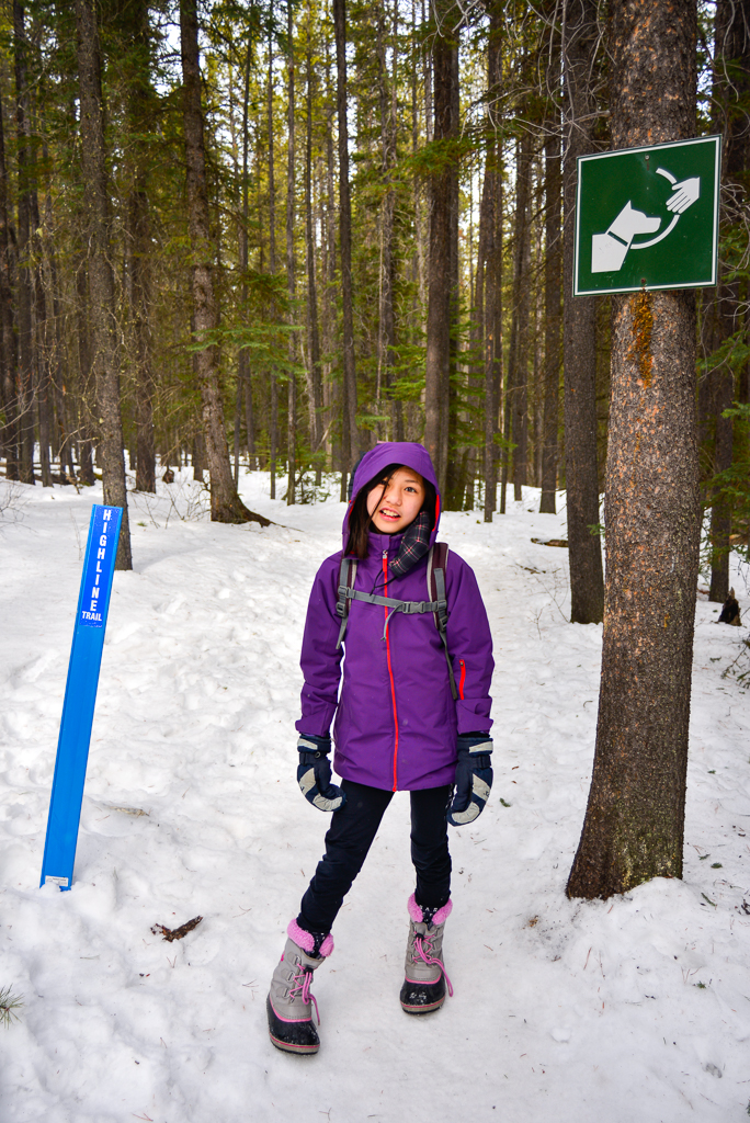
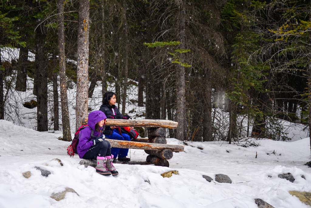
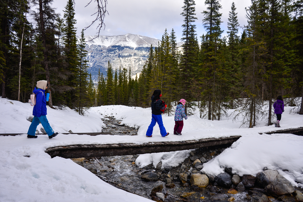
Start out on the broad, well-marked Highline Trail and follow it through the trees, keeping an eye out for bikes (Highline Trail is a popular mountain biking trail). The trail is pretty flat but climbs ever so gradually. Stay on Highline Trail until you reach a rustic picnic table by the creek. From here – or the bridge – you get a great view of the Three Sisters on a clear day.
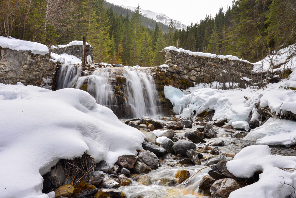
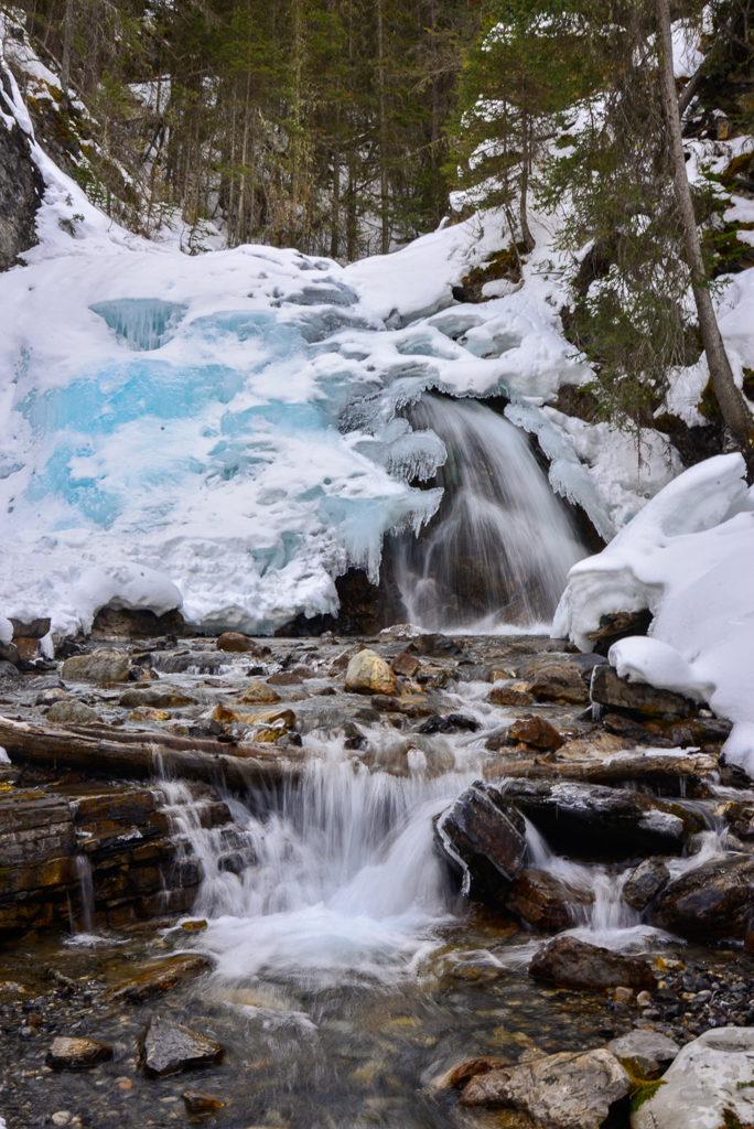
Just past the picnic table, turn left at the junction and take the small path along the creek. In about 300 metres, you will reach a small dam – a relic from the coal mining era – and small waterfall. Cross the creek downstream of the falls (before the falls), and keep to the left side of the creek to reach the Second Falls. It’s only 420 metres from First Falls to Second Falls, but you can miss them completely if you don’t know where to go!

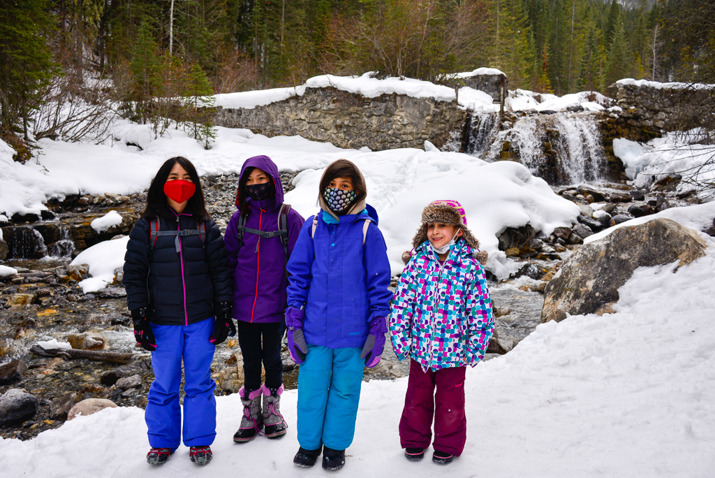
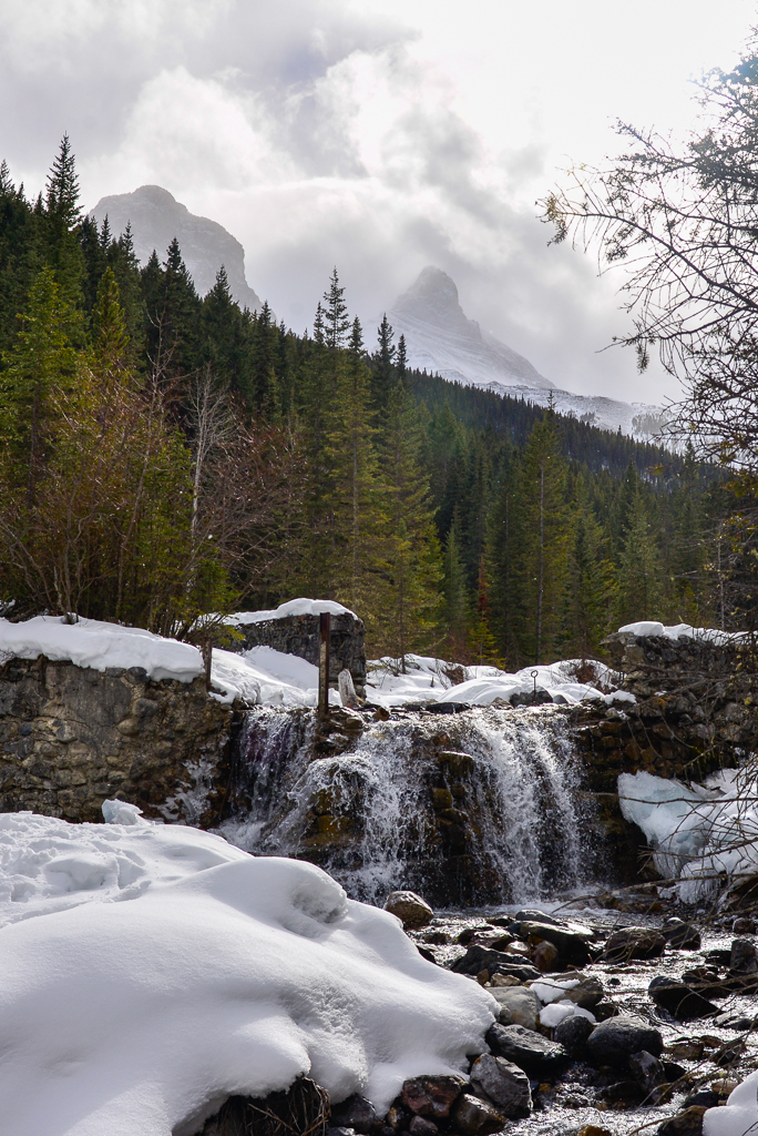
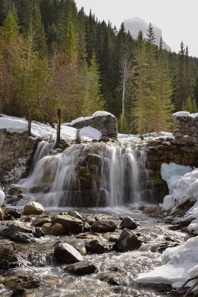
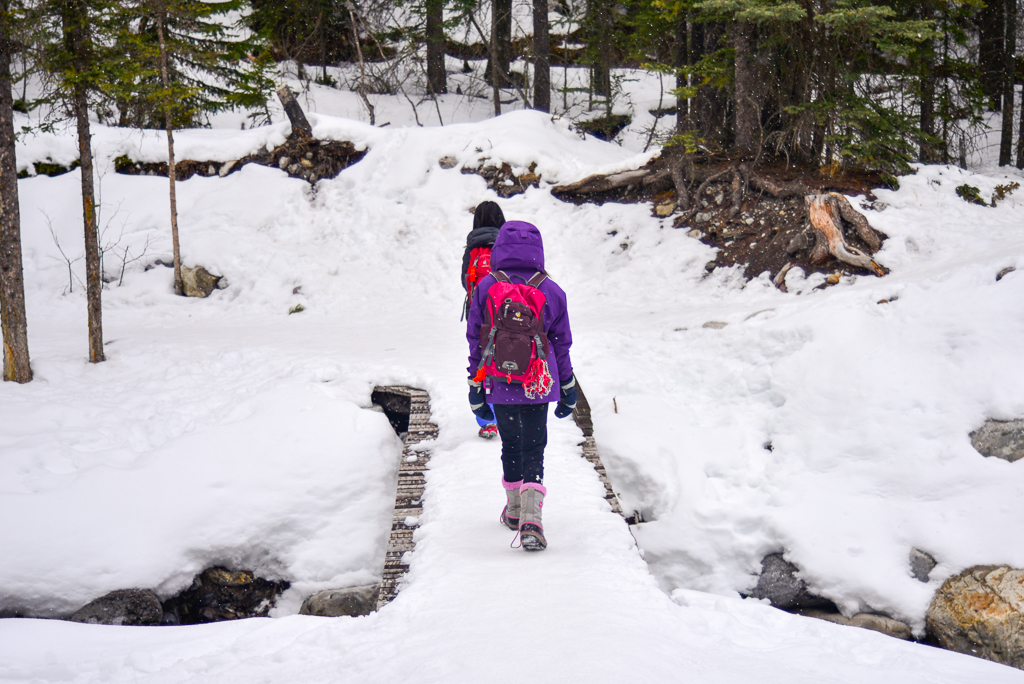
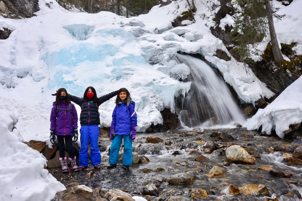
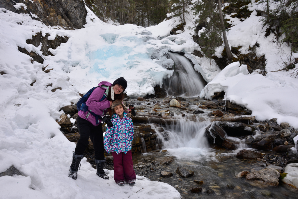
Where the path broadens and goes uphill, go to the right. By staying on the left side of the creek – you might get your feet wet here – you will end up at the base of the falls. In winter, use caution around snow bridges (it’s better to walk in in the creek rather than on snow bridges that could break), and stay back from the falls (risk of falling ice).
We thoroughly enjoyed this little hike and loved seeing not one, but TWO waterfalls, and The Three Sisters. We can’t wait to see how this trail is transformed in summer when wildflowers bloom!
Here’s a summary of landmarks along Highline Trail/Three Sisters Creek:
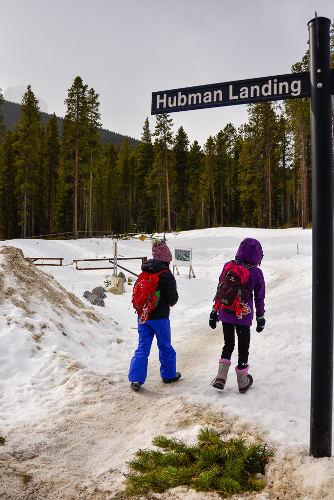
- 0 km Hubman Landing Road
- 1.29 km picnic table by Three Sisters Creek
- 1.58 km First Falls
- 2 km Second Falls
Three Sisters Creek Waterfall Trail At a Glance
- Distance: 2 kilometres one way
- Elevation gain: 150 metres
- Stroller friendly? No – rock hopping and creek crossings required
- Parking: Street parking on Three Sisters Boulevard, or Canmore Train Playground / Three Sisters Disc Golf Course Parking Lot. Click here for Google Map directions.
- Washrooms: At Canmore Train Playground
- Trailhead: Three Sisters Boulevard & Hubman Landing Road. The trail starts behind the gate at the end of Three Sisters Boulevard. If you see a sign for Highline Trail, you’re in the right place.
Know Before You Go
Highline Trail, the trail you start out on, is a popular mountain biking trail. Watch for bikes, and move to the right when a bike is approaching.
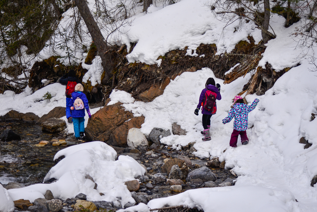
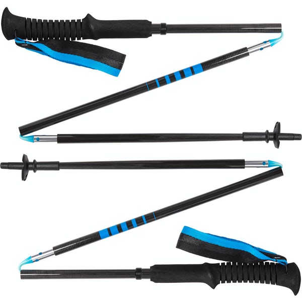
This hike involves creek crossings and rock hopping, so your feet might get wet! In late summer, this could be fun, but in winter, getting wet feet could be dangerous (bring extra socks and plastic bags to line wet footwear – just in case). There is also a risk of slips and falls, so trekking poles are recommended. From late fall to spring, we also recommend traction devices because the snow on the trail gets packed down and slippery.

Wildlife is often spotted in the area, so carry bear spray year round (cougars and wolves don’t hibernate and young bears especially will wake up mid-winter if they hear/smell something interesting). Brush up on bear safety tips in our story: 10 Bear Safety Tips for Hikers and Backpackers.
What to Bring
Disclosure: This section includes affiliate links through which I earn a commission on qualifying purchases at no extra cost to you.
Waterproof mid-height hiking boots, a down hoody or fleece, toque, gloves, and windproof/waterproof shell are recommended year round. Trekking poles are useful for long hikes, steep descents, or when you’re carrying a fully-loaded backpack (or are babywearing). You should also carry The Ten Essentials including: water, extra food, extra clothes, a first aid kit, headlamp, GPS / compass / Garmin inReach Mini 2 satellite communicator* and map of the area, mineral sunscreen, bug spray (this DEET-free insect repellent contains 20% icaridin and will repel ticks), and bear spray. Carry bear spray in a Bear Spray Holster or Scat Griz Bear Spray Running Belt.
*A Garmin inReach Mini 2 satellite communicator is highly recommended for contacting Search & Rescue and emergency contacts in the event of an emergency, or communicating with friends and family when you are out of cell phone range. You can send text messages and your GPS coordinates via satellite, but a monthly service plan is required.
In snowy/icy conditions, traction devices such as Kahtoola Microspikes (Available from Amazon, MEC, and Valhalla Pure Outfitters), or Hillsound Trail Crampons (Available at Valhalla Pure Outfitters and Sport Chek) are recommended. See our Fall/Winter Hiking Gear Guide for recommended clothing and gear.
More Short Trails You Might Like
- The Best Short Hikes Near Calgary (less than 4 km round trip)
- The Best Short Hikes in Kananaskis (less than 6 km round trip)
- The Best Short Hikes in Banff
- The Best Winter Hikes near Calgary