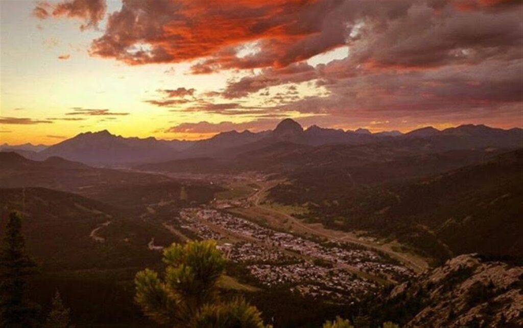
With spectacular scenery, a rich coal mining history, friendly communities, and great hiking, the Crowsnest Pass is the Canadian Rockies’ best kept secret. Whether you’re just passing through and want a short hike to break up the drive, or have a weekend to bag some peaks, there is a wide range of trails in The Pass that will take your breath away.
With so many hikes to choose from, I called upon local residents, Pam Drover and Heather Davis, to help select the top 5 hikes in the Crowsnest Pass.
For complete details – including directions to the trailheads and route descriptions – please see my story on ZenSeekers.
1) Turtle Mountain – North Peak
6.2 km return, 900 m elevation gain

“Turtle Mountain is an all time favorite… that most people want to do,” Heather Davis says. Known to First Nations as “the mountain that moves,” Turtle looms over the pass and is responsible for Canada’s deadliest rockslide. Over 80 million tons of rock came crashing down on the town of Frank in 1903.
While the summit offers a spectacular bird’s eye view of Frank Slide and the surrounding peaks, the view must be earned. This scramble is extremely steep with considerable exposure and loose rock, so wear good hiking boots and stay back from the edge.
2) Frank Slide Interpretive Trail & Leitch Collieries
1.5 km and 800 m respectively.
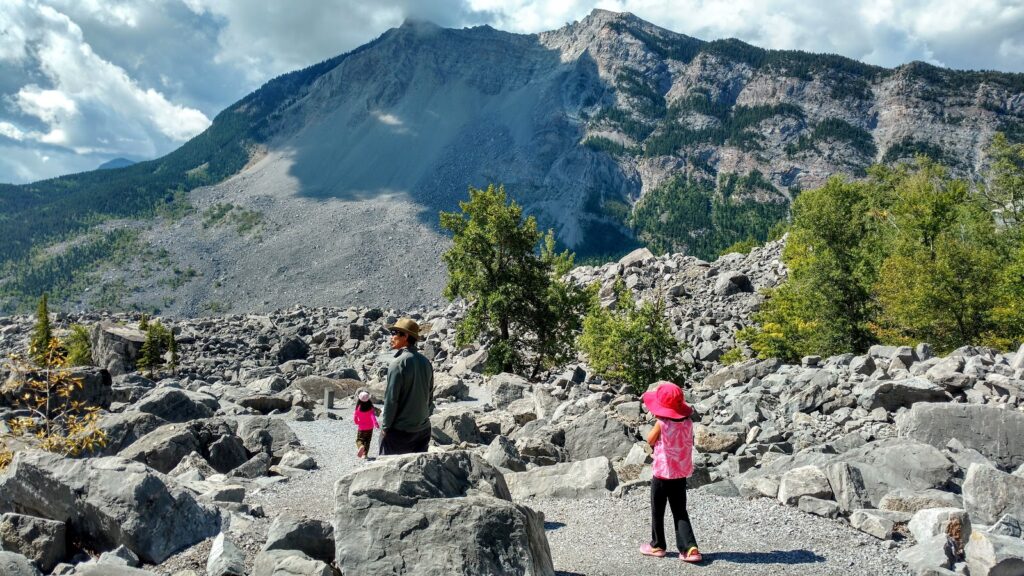
A 1.5 km interpretive gravel trail meanders through boulders left in the wake of Frank Slide. Allow time to explore the Frank Slide Interpretive Centre ($) adjacent to the trailhead to learn more about life before, during, and after Canada’s deadliest rockslide.
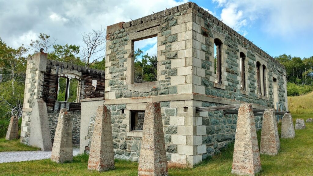
Nearby Leitch Collieries Provincial Historic Site, east of Bellevue, is another must-see. Explore the ruins of this ultra modern (for its time), but jinxed, coal mining operation on a 0.8 km wheelchair accessible trail. Admission by donation.

3) Window Mountain Lake
4.4 km round trip, 218 m elevation gain
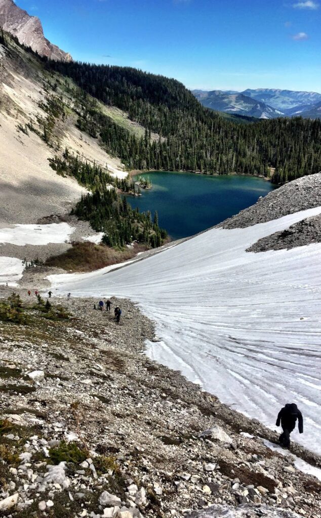
Window Mountain Lake is a local’s favorite. The pretty, alpine lake is accessed via Alison Creek Road and offers great fishing and views. There’s a small island near shore that is fun to explore, and adventurous souls seeking a longer hike, may scramble to the top of Mount Ward (add 1.6 km one way and 470 m elevation gain). Access to this spot is tricky, and there is no signage on the logging road, so write down directions before you head out.
4) Star Creek Falls Loop
1.6 km loop, 114 m elevation gain
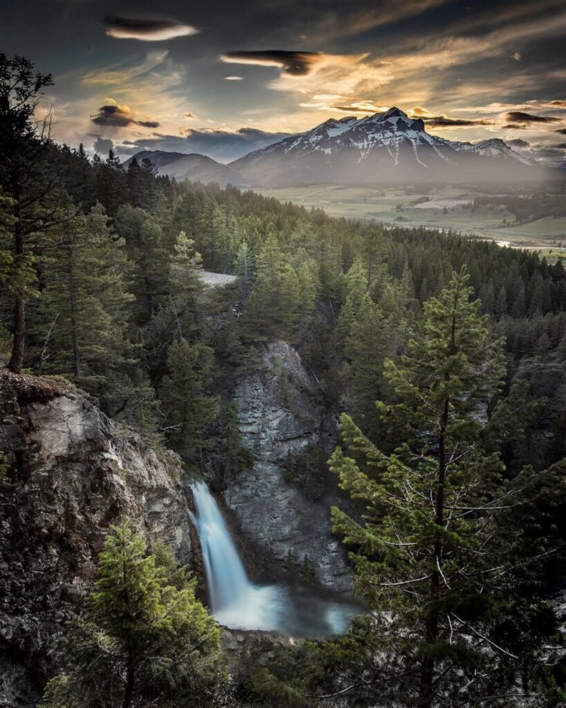
Star Creek Falls is a hidden gem in West Coleman. The cool features of this short, but scenic hike include two bridges, two viewpoints of the falls, and a 75-metre deep canyon.
5) Crowsnest Mountain
10.8 km return, 1100 m elevation gain
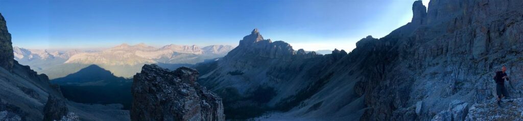
The pre-eminent peak in the area is Crowsnest Mountain, known locally as ”The Crow”. Visible throughout the Crowsnest Pass, this distinctive mountain offers fun, but challenging scrambling, and epic views of the Seven Sisters. Route finding and intermediate scrambling skills are required.
For more information on The Top 5 Hikes in The Pass (driving directions, route descriptions), check out my story on ZenSeekers. To discover more things to do in the Crowsnest Pass, visit gocrowsnest.ca.
Related Posts
- Allison Creek Falls, Crowsnest Pass
- A Fun Weekend at Beauvais Lake Provincial Park
- Camping at Lundbreck Falls
- Why You Should Visit Frank Slide Interpretive Centre
2 comments
Is the forest open for hiking after the fire ban?
It sounds like the Forest Area Closure for the Crowsnest Pass has been lifted as of September 21, but I would check in at a local Visitor Centre before heading out just in case. https://www.facebook.com/permalink.php?story_fbid=1671815979537563&id=454421064610400
Comments are closed.